
Research and development
The research
behind the model.
How we teach the pipeline to read streets, rebuild individual buildings and keep every result traceable, with the results so far and what comes next.
01 / Street-image AI
Teaching the pipeline
to read a street.
Maps say where a building stands and how tall it is. They do not say where its door is, how many windows it has or whether it has a bay. Street photographs do. This research builds the steps that find those features and attach them to the right address.
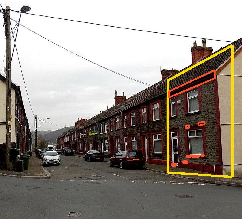
Find the street
Openly licensed, geotagged photographs are matched to named streets, and each one is reviewed before use.
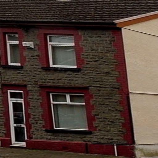
Straighten the facade
An outlined house front is warped into a flat, square view, so windows and doors line up.
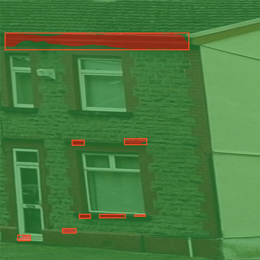
Label the parts
A segmentation model labels each pixel as wall, window, door and more.
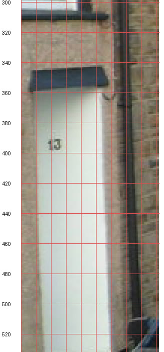
Match the address
A readable house number, here 13 Lee Street, joins the photograph to the property's UPRN.
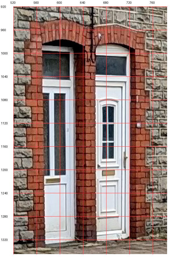
Feed the building
Reviewed features such as doors, fanlights and brick arches go into that property's model.


Scored before it is trusted.
Models are tested on three Pontypridd streets they have never seen, against hand-drawn masks, with pass marks fixed before testing. The first two off-the-shelf models did not pass, so neither is allowed to change a building.
That result sets the next steps: stronger visual features such as DINOv2 for matching photographs to buildings, and combining several photographs of each house.
| Model | Windows | Doors | Result |
|---|---|---|---|
| SegFormer-B0 trained on facade images (CMP) | F1 0.00 | F1 0.09 | Not passed |
| SegFormer-B0 trained on everyday scenes (ADE20K) | F1 0.01 | F1 0.00 | Not passed |
| Pass mark | F1 0.30 | F1 0.25 |
- MeasuredImage retrieval features served from cache in 1.6 ms per view
- Up nextDINOv2 visual features, with the local runtime already installed
- LaterMulti-view reconstruction from overlapping photographs
- RuleNo model output changes a building without review
Photographs: Hurford Crescent by John Lord; Hurford Street, Lee Street and Pwllgwaun Road by Jaggery; all via Geograph Britain and Ireland under CC BY-SA 2.0. Crops, outlines and model overlays are shared under the same licence.
02 / Buildings
The right building,
in the right place.
Each building starts from its mapped footprint and measured height. The pipeline adds roof shapes, party walls, bay windows, doors, window frames, chimneys and rainwater goods, and keeps measured and generated detail apart.


One property at a time
Buildings carry their property identity (UPRN), so evidence about a house reaches that house and no other.
Measured and generated, labelled
Positions, footprints and heights come from source data. Generated facade detail is labelled as generated in the app.
Built for close inspection
Recessed openings, glass with room depth, roof edges and stone relief hold up at street level.
What comes next
Property-specific facades from reviewed street-image evidence, street by street.
03 / Roads and pavements
Roads that sit
on real ground.
Mapped roads become carriageways with lanes, junction markings, kerbs, footways and tactile paving, fitted to LiDAR elevation so steep streets, bridges and cuttings join cleanly.

Lane structure
Lane layouts, turn restrictions and junction geometry compile from the mapped network, with roads on different levels kept apart where they cross.
Kerbs and footways
Kerb lines, footways and tactile paving at crossings follow the source footway layout.
Markings with a source
Centre lines derive from the network. Yellow lines appear only where a verified source supports them.
Slopes and cuttings
Road cuttings and embankments blend into the hillside across the terrain grid.
04 / Materials and light
Stone, slate
and summer grass.
Scanned materials, sunlight, a modelled sky and planting give each street its look.

Surfaces at real scale
Masonry, slate, paving and ground materials are applied at real-world dimensions, with surface relief and weathering.
Sky and light
The DirectX 12 renderer draws sunlight, shadows, a physically based sky and cloud that drifts with the breeze.
Trees and grass
Trees follow mapped canopy. Near the camera, grass is drawn blade by blade, and trees and grass move in the same breeze.
Quality that scales
Performance, High and Ultra quality levels let the same town run on a laptop or at full detail on a desktop.
05 / Traffic engine
Where VeriStreet began:
traffic you can rewind.
The first release, in May 2026, was a deterministic traffic engine. The same inputs always produce the same run, so a change can be measured against an identical baseline. Simulated traffic is not yet part of the 3D world.
Vehicles in a recorded engine benchmark.
Reference cases matched in the event-engine equivalence tests.
Research junctions used to test gap acceptance at locations left out of fitting.
Checked against recorded driving
Gap acceptance at junctions was fitted to recorded driving and tested at locations left out of the fitting.
Known limits
A roundabout behaviour model that did not pass its cross-dataset test stays switched off. Wider calibration is needed before results can support real-world decisions.
Research data
The inD, openDD and rounD experiments use research datasets, which do not grant commercial rights to the data or to models derived from them.
Standard exports
Road networks export to OpenDRIVE, placed on real-world coordinates.
06 / Live data
Connecting to
what is happening.
Experiments bind public traffic and roadworks feeds to the road network, as groundwork for replaying real conditions.
Roadworks
DfT Street Manager notifications have been received by VeriStreet's endpoint since 4 August 2026 and filtered to the Bristol area.
Traffic counts
Bristol City Council VivaCity counts, hourly and by vehicle class, published under the Open Government Licence.
Journey times
18,442 Bristol ANPR journey-time records from October to December 2024, used as a historical speed reference.
Flow speeds
TomTom flow observations matched to 308 of 11,468 Bristol network edges, about 2.7%, in an August experiment.
07 / The desktop app
One workspace
for the whole job.
The app is built with WinUI 3 and DirectX 12. World, Analysis, Data, Live / Replay and Settings pages keep each task in its place while the same project stays open.


Follow the work
See what
changed this month.
The development journal lists everything built since May 2026. For a closer look at any area, talk to the founder.